Postcodeheatmap
Turn your spreadsheets into beautiful map visualizations
Featured
62 Votes
Description
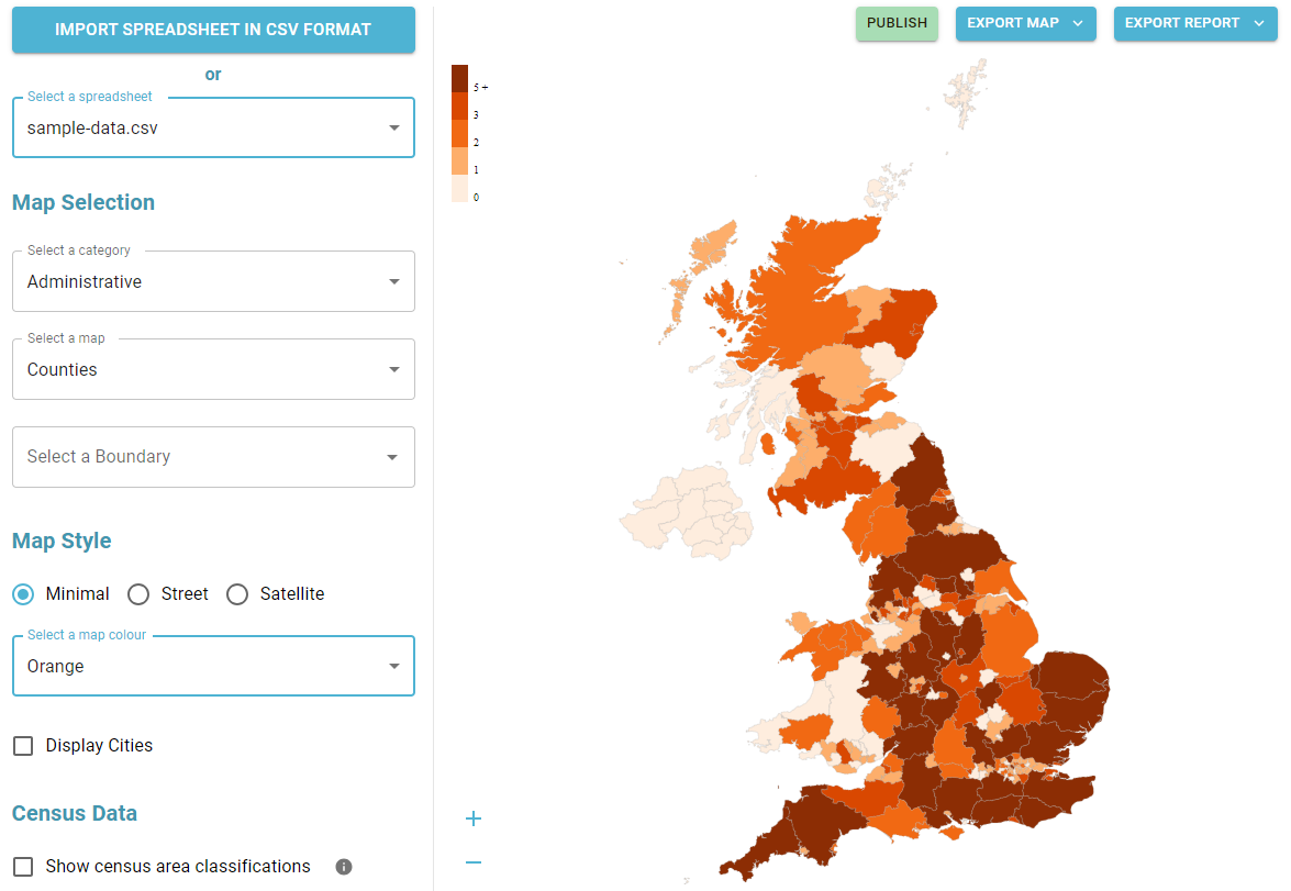
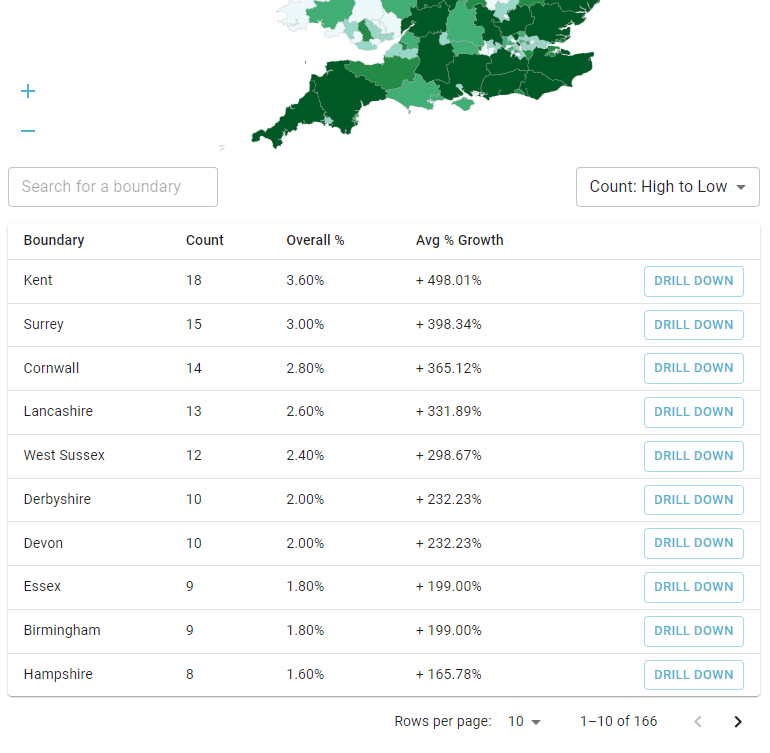
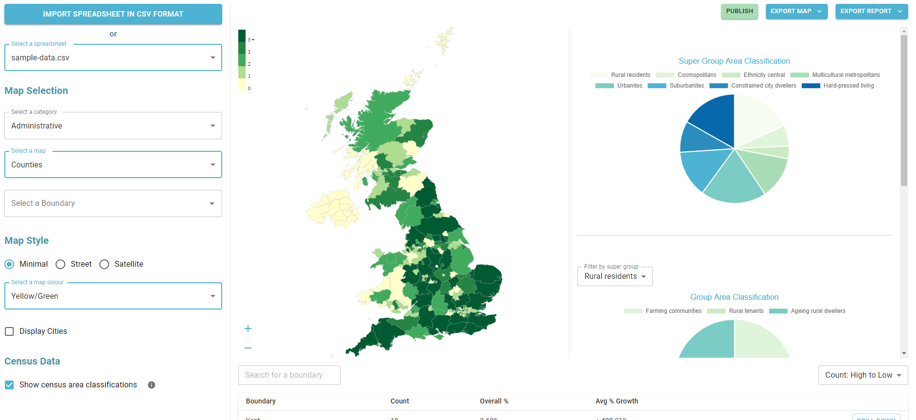
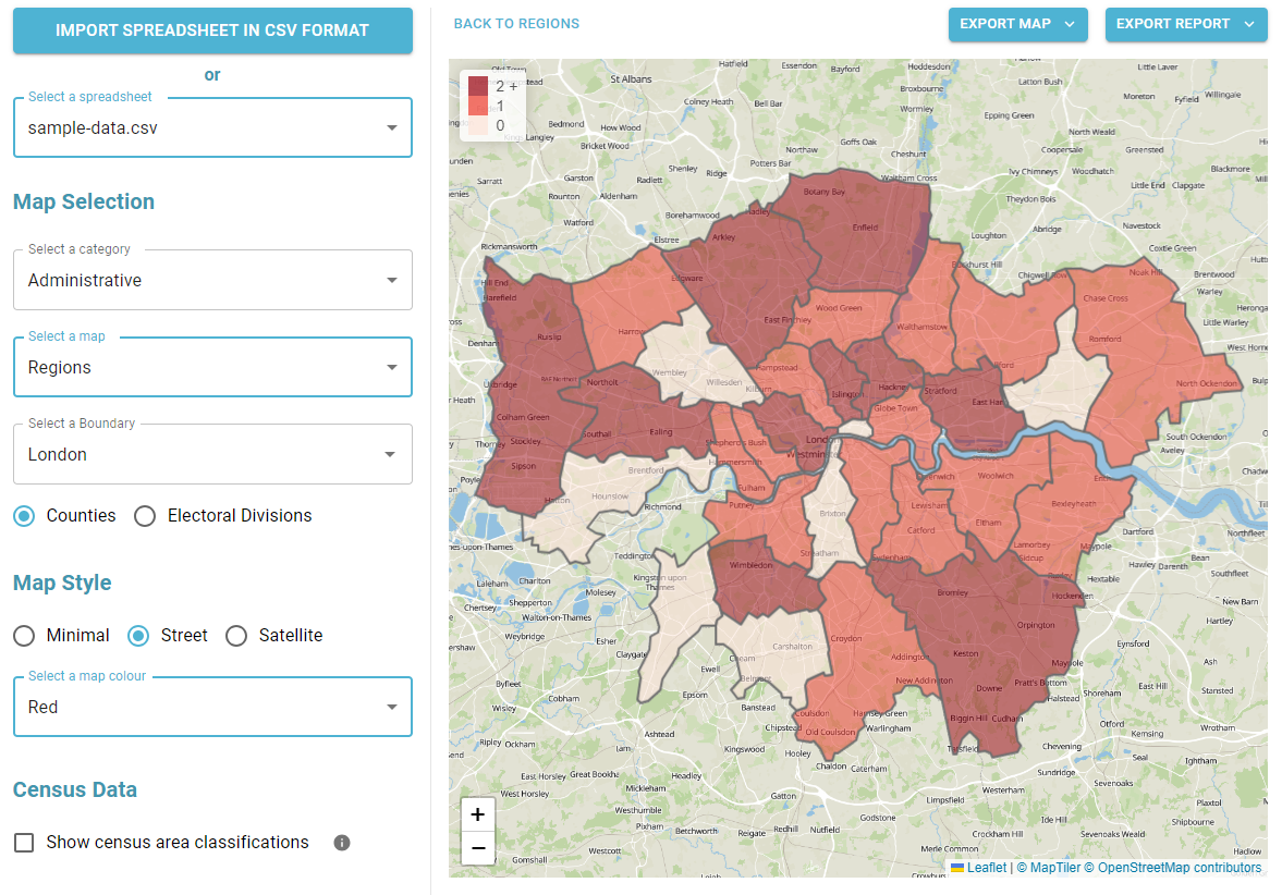
A super simple tool to visualise your customer density across UK geographic boundaries such as counties and regions. Just upload a spreadsheet of postal codes and then export your heat maps as images or generate reports.