StarEngine Geospatial
Medium-low resolution satellite image platform
Featured
5 Votes
Description
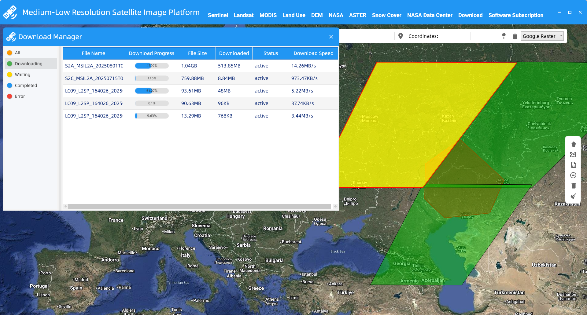
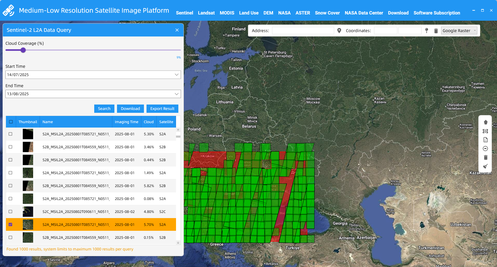
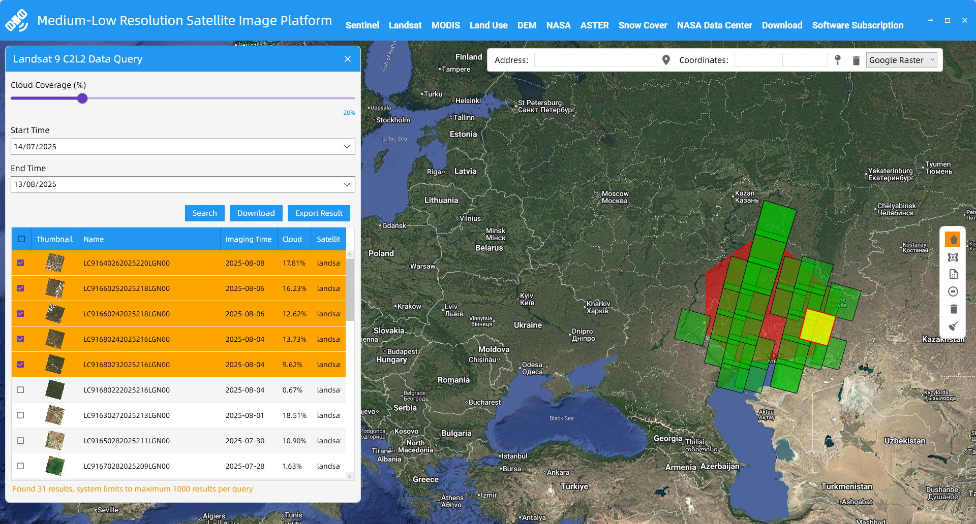
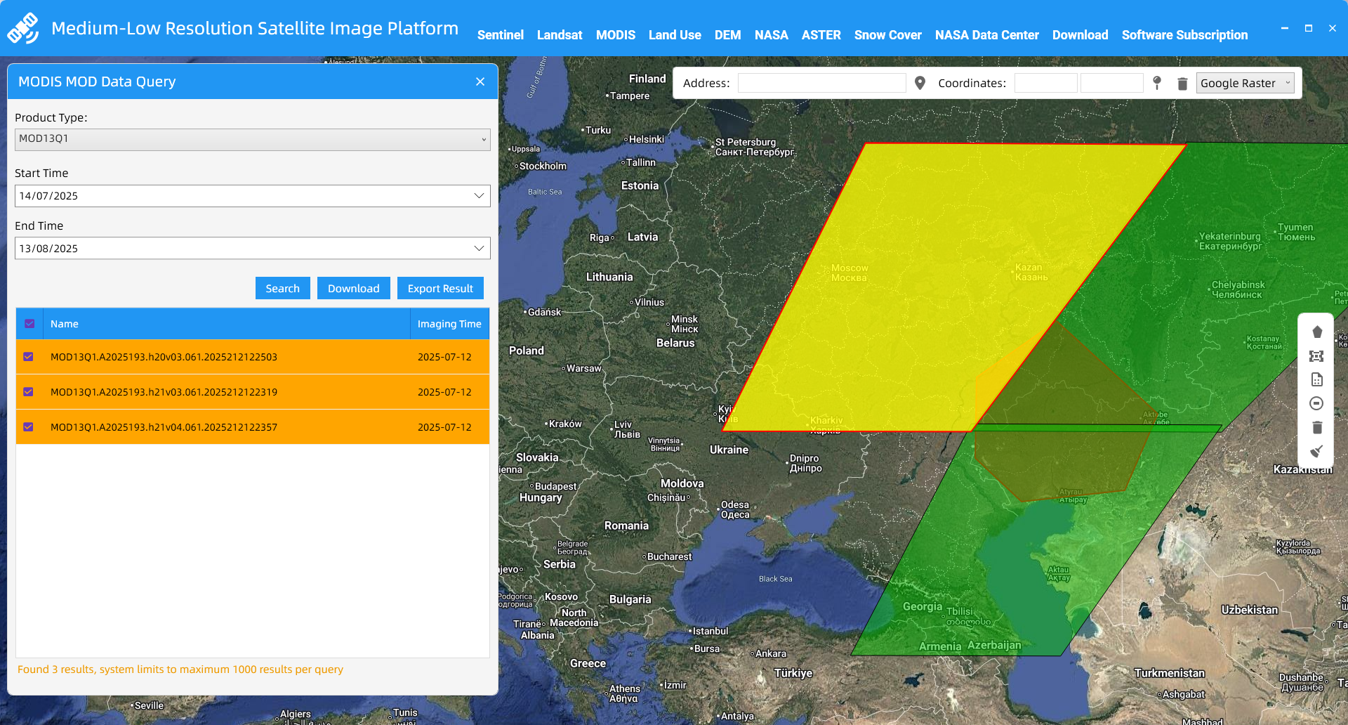
An all-in-one remote sensing data platform for Sentinel, MODIS, and more. Supports batch downloads via SHP/polygon with auto-retry. Stop wasting time on downloads, focus on analysis, and boost efficiency.